The CaGIS Distinguished Career Award honors the accomplishments of senior professionals who have contributed substantially to the advancements of the fields of cartography, GIS or GIScience, or the interface between cartography and GIScience.
Distinguished Career Award Winners
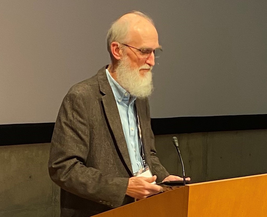
Barbara (Babs) Buttenfield (2023)
Alan MacEachren, Penn State (2022)
Terry Slocum, University of Kansas (2020)
Kari Craun, USGS (2020)
Tim Trainor, US Census (2018)
Michael Dobson, TeleMapics, LLC (2016)
A. Jon Kimerling, Oregon State University (2014)
Keith Clarke, UC Santa Barbara (2013)
E. Lynn Usery, US Geological Survey (2012)
Jerome Dobson, University of Kansas (2008)
Nominations
The selection process for the Distinguished Career Award is based on a nomination letter and a supporting record of achievements. All complete nominations will be evaluated by an Awards Committee determined by the CaGIS Board of Directors.
While the nominee does not need to be a CaGIS member, a CaGIS member must submit the nomination. No self-nominations are allowed. Nominations should include a statement detailing why this individual’s career is worthy of distinction. The statement should synthesize the nominee’s career achievements through a portrait of their professional history, methods, and other relevant biographical information. Career achievements may include publications, professional posts held, influence on government and policy, students mentored, systems development, and other measures of a distinguished career. The Awards Committee will retain nominations that are not successful in the year that they are submitted for consideration in the next competition. Those who have submitted unsuccessful nominations in the past are encouraged to revise the submissions and submit them again this year.
Eligibility: Nominees must have contributed to research, teaching, service, government, and/or commercial developments in cartography, GIS, and/or GIScience. The nominee does not need to be an active member of the CaGIS Society. The nominee’s contribution may extend over a period of several decades but should also include evidence of active work in the past ten years.
Award: The award consists of an engraved plaque, recognition in the journal Cartography and Geographic Information Science and the CaGIS website, and a one-year complimentary membership to the Society. The recipient will be invited to speak at one of the conferences that CaGIS is affiliated with. A stipend will be available to offset travel costs.
Nomination Package:
- A 1000-word statement on the nominee’s contribution to the field of cartography, GIS, and/or GIScience
- 2 pages (maximum) of nominee’s relevant accomplishments
- Optional letters of support from other CaGIS members
Submissions should be sent to the current President of CaGIS for consideration. Nominations are reviewed February 28 of each calendar year.
Distinguished Career Award Winners

Barbara (Babs) Buttenfield (2023)
University of Colorado
Dr. Barbara Buttenfield is a Professor Emerita of Geography at the University of Colorado where she is also the Director of the Meridian Research Lab which develops GIS applications and explores algorithm design and testing to advance knowledge about GIScience. She has had an illustrious and influential career in cartography and GIScience and continues contributing to the field while enjoying emerita status. She has had a long-standing focus on data generalizing and modeling, and she has made significant contributions to multi-scale mapping and database design, perhaps most notably through her continuing Research Faculty affiliation with the USGS Center for Excellence in Geospatial Information Science (CEGIS). Dr. Buttenfield’s diverse interests also include terrain modeling, dasymetric modeling, representations of uncertainly, error/accuracy assessment of spatial data, and graphical interface design and usability and evaluation, among other topics of relevance in cartography and GIScience. She has hundreds of publications in a variety of outlets; given and been invited to give presentations nationwide and internationally; won numerous awards for both her research and teaching; been an investigator on research grants earning millions of dollars; served as the lead and member on numerous national and institutional committees; and mentored scores of students, many of whom went on to hold prominent positions in academic, government, and the private sector.
In addition to her many academic and professional accomplishments, Dr. Buttenfield has been a leader in CaGIS and other professional societies. Her contributions to CaGIS (and previously the ACA) span more than two decades and include serving as a board member from 1990-1992 and again from 1994-1997 while she was president of the society from 1995-1996. The Society and its journal were shifting from cartography to geographic information systems to GIScience. In 1992, she surveyed ACA members to determine their interest in GIS, and she published the results in the society journal.4 In 1997, she was elected as an ACSM Fellow. She served on a Strategic Planning Committee from 2004-2005 to develop a plan for the Society to be more inclusive of geographic information systems and science. She served as the associate editor of the Cartography and Geographic Information Systems journal from 1993-1996. She has been on the editorial board of the CaGIS journal since 1991. In addition, she has served on the Program Committees for AutoCarto every year since 2010.
Dr. Buttenfield has also been integrally involved in the ICA, UCGIS, NACIS, and AAG. For the ICA, she has served on the Scientific Program Committee for the International Cartographic Conferences and workshops of the ICA Commission on Generalization and Multiple Representations since 2011. For her service to the organization, she was elected as a Fellow of UCGIS and was awarded its inaugural National GIScience Educator of the Year Award in 2001. In 2020, she was honored with the AAG’s Distinguished Teaching Honors.
And last but certainly not least, Dr. Buttenfield is also an advocate for women in science, as is evidenced by these activities and achievements: From 2017 to 2021, she was a Project Director of the Training and Retaining Leaders in STEM (TRELIS-GS) project mainly funded through the NSF to address the low level of participation by women in geographic information science and technology; In 2010, she was elected to membership in the Society of Women Geographers; In 2013, she was one of nine women cartographers whose career is highlighted in Map Worlds: History of Women in Cartography by WC van den Hoonard, Wilfrid Laurier University Press.
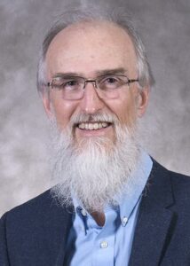
Alan MacEachren (2022)
Penn State University
Alan MacEachren’s innovative contributions to cartography and GIScience have spanned decades, as his early research in geographic representation and geovisualization coincided with the rise of scientific visualization. Since the 1980s, he has helped guide the national and international development of geographic visualization within cartography and GIScience to its current form as geovisual analytics, defined as the science of analytical reasoning facilitated by interactive geovisual interfaces. He also has worked diligently to expand the reach of cartographic scholarship and influence to allied disciplines, such as computer-supported cooperative work, human computer interaction (HCI), information visualization, visual psychology, and usability engineering.
Dr. MacEachren’s book How Maps Work, published in 1995, formalized and refined a cognitive-semiotic basis for geographic visualization in cartography, providing a guiding theoretical foundation for cartography at the same time that the discipline and profession were transitioning to interactive, online, and mobile media. Dr. Gennady Andrienko calls this book “the most important reading for all people working in the area of geovisualization.” Dr. MacEachren’s theoretical contributions to cartography remain central to contemporary scholarship in our discipline, and How Maps Work ranks among the most-cited cartographic research texts to date. Dr. Menno-Jan Kraak said that Dr. MacEachren has “been instrumental in introducing the modern meaning of the word ‘visualization’ in our discipline, and it could be argued that this created a new school of thought in cartography.”
Dr. MacEachren is accomplished in research, teaching, mentoring, and service and has received numerous awards from the International Cartographic Association (including the ICA’s highest honor, the Carl Mannerfelt Gold Medal), the American Congress on Surveying and Mapping, the American Association of Geographers, the Canadian Cartographic Association, Ohio University, and others. He has been awarded three different fellowships at Penn State University as well as fellowships in the International Cartographic Association; the American Congress on Surveying and Mapping; and the American Association for Advancement of Science, among the highest distinctions for a research scientist in any discipline in the United States. Additionally, he was named a member of the IEEE Visualization Pioneers Group. He has also received multiple awards for his teaching efforts (detailed below in the summary of his relevant accomplishments).
Dr. MacEachren’s contributions can perhaps be neatly summarized in this statement from Dr. Mark Gahegan: “It would not be overstating the case to say that he has almost single-handedly moved the field of cartography forward into the computer age and, in doing so, pioneered the entire field of geovisualization, being the first among his peers to truly embrace exploratory information visualization; immersive reality; multimodal interfaces; collaborative virtual environments; crisis management systems; and, most latterly, visual analytics, to name but some of his achievements.”

Terry Slocum (2020)
University of Kansas
In 2020, the CaGIS Board of Directors awarded the Distinguished Career Award to Terry Slocum. Throughout his academic career, Dr. Slocum was a dedicated teacher and mentor. His courses and seminars covered topics including quantitative and cognitive cartography as well as geographic visualization. He also taught courses in developing cartographic software and quantitative methods. Professor Slocum’s research interests have included visualizing data uncertainty, data exploration, map animation, stereoscopic displays, history of thematic mapping, and the use of color. He has published in numerous other prominent refereed outlets, including the Annals of the Association of American Geographers, The Professional Geographer, The Cartographic Journal, and Journal of Geoscience Education, and is the is lead author of the widely used cartographic textbook Thematic Cartography and Geovisualization.
Dr. Slocum was editor of the 1995 U.S. National Report to the International Cartographic Association, which was published as a special issue of Cartography and Geographic Information Systems. From 1999 to 2002, he served as editor of Cartography and Geographic Information Science. He also served as an officer in the Cartography and Geographic Information Society, most recently as President from 2013-15. During his academic career, he has been involved in numerous grants, including six from the National Science Foundation, and has received two Teacher Appreciation Awards from the Center for Teaching Excellence (CTE) at the University of Kansas. He has chaired fourteen dissertation and theses committees and served on more than seventy dissertation and thesis committees. As Chair of the Geography Department his leadership was instrumental in helping the department expand from 15 to 22 members.

Kari Craun (2020)
U.S. Geological Survey
In 2020, the CaGIS Board of Directors awarded the Distinguished Career Award to Kari Craun. Ms. Craun is well recognized for her contributions to cartography serving as the Director of the National Geospatial Technical Operations Center (NGTOC) where she guided the development of The National Map of the U.S. Geological Survey and the design, development, and production of US Topo, the modern digital topographic map of the United States. Ms. Craun served as a Board member, Treasurer, and President of the Cartography and Geographic Information Society (CaGIS), Past-President of the American Society for Photogrammetry and Remote Sensing (ASPRS) and received the ASPRS Claude H. Birdseye Presidential Citation in 2007 and the ASPRS Outstanding Service Award in 2013. She was honored as an ASPRS Fellow in 2012. She received the Department of the Interior Meritorious Service Award in 1996.
Kari Craun received the prestigious Henry Gannet Award of the U.S. Geological Survey for her contributions to the generation of new topographic maps, in the form of US Topo, for the 48 conterminous United States. Ms. Craun was tasked by the management of the National Geospatial Program in October of 2008 to establish a production capability to automatically generate more than 55,000 7.5 minute, 1:24,000-scale topographic maps on a repetitive 3-year cycle and to include the basic content of the traditional topographic map series that had required over 50 years to complete. The new US Topo quadrangles are generated in a GeoSpatial PDF format, ready for use on a computer system or for printing with standard USGS topographic map symbology. Ms. Craun, Director of NGTOC, assembled a staff for the production operation and began generation of a beta product in May of 2009, following with full production of topographic maps in October of 2009. Overcoming obstacles of errors in the geospatial databases that would be the base of the map production operations, scheduling of contractual operations, and continually fine-tuning the production operations, the NGTOC, under Ms. Craun’s leadership, established an automated production process that continues to improve the operations and the product. The process requires that all data be available and pre-staged to support the production of over 100 maps per day. In September of 2012, the last of the quadrangles that would complete the first cycle of 48-state coverage rolled from the automated Maps on Demand (MOD) system and immediately the system began a repeat of the process to regenerate another 55,000 maps in the next three years.
Ms. Craun, as Director of the NGTOC, is responsible for a wide range of functions in support of maintaining a seamless, current, nationally consistent coverage of base geospatial data for the United States. It was the availability of these data that made US Topo possible. The Center also develops a wide range of digital and graphic products, including USGS topographic maps and digital and graphic products, and data services from The National Map. The Center manages several broadly scoped contract mechanisms for acquisition of geospatial products and services through the commercial sector.
Ms. Craun also is a fitting recipient of the CaGIS Distinguished Career Award in the broader scope of her cartographic and geospatial activities. Ms. Craun received a B.S. degree in Geology from the University of Missouri-Kansas City in 1984 and an M.S. degree in Photogrammetry from Purdue University in 1987. Prior to coming into her current position, Ms. Craun was Chief of the USGS Central Region Partnership Office. There she was responsible for development of partnerships with other federal, state, and local governments, as well as with the private and academic sectors, for furthering the development of the National Spatial Data Infrastructure. She had previously worked in other positions with the USGS in both Rolla, Missouri, as Chief of the Mid-Continent Mapping Center, and in Reston, Virginia. Before joining the USGS in 1988, she was with the Defense Mapping Agency in San Antonio, Texas, and Brookmont, Maryland.
Ms. Craun has also served CaGIS in a variety of capacities for many years as a CaGIS individual member, Board member, president, and treasurer and in activities in conference organization and management. She served on the organizing Committees for Auto Carto Symposia and the 2017 International Cartographic Conference (ICC) in Washington, D.C. In addition to being on the 2017 ICC organizing committee, she also served as CaGIS treasurer during that time managing the conference budget.
Tim Trainor (2018)
U.S. Census
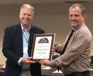
The CaGIS Board of Directors recognized Timothy Trainor with the Distinguished Career Award, presented at the CaGIS Members Reception on April 12, 2018. CaGIS President Matt Rice (2017-2018) cited Tim Trainor’s 35-year history at the US Census Bureau where he recently served as Chief Geospatial Scientist, and decades of service to the International Cartographic Association, for which CaGIS is the U.S. national representative body. The nomination letter cites “one of the distinguished contemporary careers in the US geospatial community” and Trainor’s significant role in the United Nations Global Geospatial Information Management (UN-GGIM), where he currently serves as Co-Chair with Li Pengde (China) and Dorine Burmanje (Netherlands). “Tim Trainor has had a central role in MAF/TIGER, the national address databases, boundary data, road data, and the implementation of improvements in geospatial technology and processes that have saved Census hundreds of millions of dollars.”
In July 2019, Tim Trainor was elected through a vote of a majority of world delegates to be the President of the International Cartographic Association (ICA) for a term of four years. This role is another achievement in a remarkable career and will give Trainor an important role in leading the international cartographic community. In a personal note, Rice stated: “Tim’s influence on my own career, and on the careers of other CaGIS Past Presidents and Officers has been profound. At his retirement celebration, Kaile Bower, a Past President of CaGIS and long-time Census employee remarked on how gracious and inclusive Tim Trainor has been with junior members of the geospatial community and with employees at Census. When participating in meetings, conferences, or events, Tim always brought along a junior member of his staff or a junior member of the community to mentor them, and to help them feel a part of the activity. Tim’s tremendous role in shaping and mentoring future leaders of CaGIS is, by itself, worthy of recognition.” CaGIS offers our congratulations to Tim on his Distinguished Career Award and his recent election to the Presidency of the International Cartographic Association.
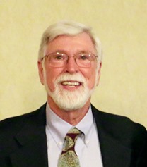
Michael Dobson (2016)
TeleMapics, LLC
Over a period of four decades, Michael Dobson has been at the cutting edge of both academic and operational cartography. Dr. Dobson has made significant contributions in cartography and GIS from positions in academia, industry, and, through consultancy, government, for more than four decades. Throughout these years, he has promoted, and perhaps provoked, wider thinking about cartography and geospatial information.
Dr. Dobson received his Masters degree in geography and conducted his PhD work at the University of Kansas in the early 1970s under the guidance of Professor George Jenks. Mike subsequently taught at the State University of New York at Albany for 13 years. During his time as an academic, he proved to be a formidable but very well liked teacher and many of his former students have gone on to play key roles in academia, industry and government service. During his years at Albany he undertook early, groundbreaking research on such topics as “Eye movement parameters and map reading,” (The American Cartographer)’, “Bench marking the perceptual mechanism for map-reading tasks,” (Cartographia); and “The influence of the amount of graphic information on visual matching,” (The Cartographic Journal).
Although he easily won promotion to a position as Associate Professor, he felt that his interests were increasingly turning to operational questions in the new world of digital cartography. After a period of consulting, Mike was hired by Rand McNally as their Chief Cartographer and Chief Technologist and later as a concurrent Vice President. His work with Rand McNally was highly thought of and he remained with the firm for over 13 years. During his latter years at Rand McNally, Mike became more and more involved in specialized client maps involving location-based services.
Upon his departure from Rand McNally, Mike served for two years as Chief Technical Office and EVP Engineering for go2, a company that was heavily involved in the provision of POI data in the form of location-based and mapping services over cellular networks to mobile phones and desktops. Mike, by this time, had become a highly sought after consultant in the areas of digital cartography and location-based services and he established himself as an independent consultant forming TeleMapics, LLC after two years with go2.
Mike is a past member of the Mapping Sciences Committee of the National Research Council of the National Academy of Sciences. Over the last decade, Mike has also made a very substantial contribution to the general cartographic and GIS community through the provision of his widely read blog “Exploring Local”. This blog exposes a wider community to issues and concerns in contemporary spatial data handling.
For these reasons, CaGIS would like to honor Dr. Michael Dobson with the Distinguished Career Award for his contributions to the society and the profession as a leader in Cartography, GIS, and GIScience.
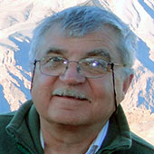
A. Jon Kimerling (2014)
Oregon State University
A. Jon Kimerling received his BA from the University of Washington in 1972 and his MA and PhD from the University of Wisconsin at Madison in 1973 and 1976, respectively; it is noteworthy that it took him only one year to complete the Master’s degree and three years to complete the PhD, graduating with the PhD at the age of 26! Dr. Kimerling spent the rest of his career at Oregon State University, although he also held visiting professorships at the University of Wisconsin, what is now Curtin University of Technology in Australia, and the University of Redlands.
In the research realm, Dr. Kimerling is widely known for his work in both basic and applied research. In the basic realm, he has done research in a variety of areas, including equal-value gray scales, map projections, color specification, terrain visualization, dot mapping, and global grid systems. He has authored more than 30 refereed journal articles and book chapters, and co-edited the web book Discrete Global Grids with Michael Goodchild. His research has been supported by more than three million dollars in grants from numerous funding agencies including NSF, NASA, EPA, USDA, and DOD. In recognition of his contributions to basic research, he received the Milton Harris Award in Basic Research from OSU in 1996.
In the applied research realm, Dr. Kimerling has been involved in several map production efforts. He was co-editor of several editions of the Atlas of the Pacific Northwest, was co-author of the Atlas of Oregon Wildlife and was the lead author of the Atlas of the Interior Columbia River Basin.
In the teaching realm, Dr. Kimerling has served on approximately 275 MA and PhD committees; he has been the lead advisor on 10 PhD and 56 Master’s committees. It is not surprising that students speak highly of his teaching. In her nomination statement, Aileen Buckley noted his use of humor and obvious enthusiasm, and his humaneness. The latter is well illustrated by a graduate seminar that she took with him – she stated: “How like him to offer the course at his home in the evenings accompanied by a meal-his students are people to him, but he still manages to demand their respect and assure their productivity.” Dr. Kimerling’s skills as a teacher are reflected by the awards that he has received from OSU: the Loyd Carter Award for Outstanding and Inspirational Teaching in Science, and the Olaf Boedtker Award for Excellence in Undergraduate Advising. Further reflecting his importance as an educator, he was co-author of the sixth edition of the Elements of Cartography, often considered the “bible” of American Cartography. More recently, he has been the lead author of the widely used introductory cartography book Map Use: Reading, Analysis, and Interpretation, now in its seventh edition.
In the service realm, Dr. Kimerling has been active at a variety of levels. He served as Editor of The American Cartographer, as President of the American Cartographic Association, which was a precursor to the present Cartography and Geographic Information society, and as Chair of the U.S. National Committee for the International Cartographic Association. He was responsible for spearheading the change in our journal name from the American Cartographer to Cartography and Geographic Information Systems. More recently, he was one of the co-editors of Cartography in the Twentieth Century, volume 6 of the prestigious History of Cartography series.
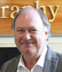
Keith Clarke (2013)
UC Santa Barbara
Keith Clarke received his BA from Middlesex Polytech in London and his MA and PhD from the University of Michigan. He was a faculty member at Hunter College from 1982-1986 and has been on the faculty at UCSB since 1996.
In the research realm, Dr. Clarke has been highly thought of for his work in four areas. His early work dealt with terrain modeling, where he used the techniques of fractals and spectral analysis to develop a novel method for estimating the fractal dimension of terrain. A second theme of Dr. Clarke’s research has involved an examination of the history of geographic information technologies and their roles in military and intelligence applications. An example of his work here is his controversial argument that a large proportion of technical developments that now underpin geographic information technologies originated in issues surrounding the Corona spy-satellite program in the 1960s.
Perhaps Dr. Clarke is best known for his pioneering work on the application of cellular automaton models to urban growth. Urban growth models are often difficult to calibrate, but his work has produced major advances. Finally, Dr. Clarke is known for his novel work in field GIS. In collaboration with others at UCSB and Iowa State, he has promoted the use of mobile computing technologies and wireless connectivity to exploit the use of GIS tools in the field. For example, he has promoted the use of computers embedded in user’s clothing.
These research ideas have been published in more than 100 refereed journal articles and book chapters, and supported by numerous grants from NSF, NASA, and USGS.
In the teaching realm, Dr. Clarke has supervised 21 PhD and 40 Master’s students, and he has frequently published papers with these students. Although certainly successful with graduate students, he also has been active in undergraduate teaching. He is author of the widely known text Getting Started With Geographic Information Systems (now in its fifth edition) and is the author of the just released e-book Maps & Web Mapping: An Introduction to Cartography. It is not surprising that in 2003 UCGIS recognized Dr. Clarke as Educator of the Year.
In the service realm, Dr. Clarke has been active at a variety of levels. For example, he chaired the department at UCSB for six years, served as President of CaGIS, served as North American editor of the prestigious journal IJGIS, chaired several National Research Council Committees, and has edited the book series in Geographic Information Science for Pearson over a 22-year period.
Reflecting these achievements, Dr. Clarke has been the recipient of numerous awards – particularly noteworthy is the John Wesley Powell Award, the USGS’s highest award for achievement.
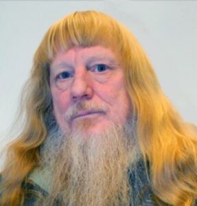
E. Lynn Usery (2012)
U.S. Geological Survey
E. Lynn Usery is a Research Physical Scientist and Director of the Center of Excellence for Geospatial Information Science (CEGIS) with the U.S. Geological Survey (USGS). Previously, he was professor of geography at the University of Wisconsin-Madison and the University of Georgia. Presently, he is also an Adjunct Professor with the Missouri University of Science and Technology.
Dr. Usery is highly thought of for the key role that he played in establishing CEGIS. He was instrumental in developing the mission and scope of CEGIS focusing on research that would further the mission of the USGS National Geospatial Program. After only five years of existence, The National Map was produced and users were provided web access to a broad range of geospatial information. A key characteristic of the CEGIS program is its integration of the government and academic research communities. Because of Lynn’s background in both arenas, he is able to provide an environment that enables collaboration between university research teams and a government-based national mapping agency. While at USGS, Dr. Usery has also developed a publication strategy and a multi-discipline rating for government scientists. Along these lines, in 2009 he received an award from the USGS for developing a multi-media set of presentation materials commemorating the USGS’ “125 years of topographic mapping.”
Dr. Usery was also highly successful while serving as a professor at UW-Madison and the University of Georgia. At Georgia, he served as the Graduate Coordinator and Undergraduate Advisor for the GIScience Certificate Programs, where he received Development Awards and Learning Grants related to technology-enhanced education in GIScience. He has supervised dozens of Ph.D. dissertations and masters’ theses in addition to serving on more than 50 Ph.D. and Masters’ advisory committees. His research interests include theoretical investigations and practical applications in GIScience, cartography, and remote sensing, including analyses of spatial resolution as it applies to environmental models; integration and generalization of digital geospatial data models in a GIS-based map rendering environment; and automated methods and improved data modeling paradigms associated with feature extraction from images. Dr. Usery was instrumental in developing a framework allowing for the representation of attributes and relationships for multiple dimensions of geographic phenomena. This model removed the necessity of viewing spatial attributes, such as location, as the fundamental basis of geography and helped establish the concept that spatial location is only one of many attributes of a particular geographic feature. Dr. Usery’s research continues to advance theoretical GIScience by investigating geospatial ontologies and semantics, data models, data integration, and grid computing for spatial data. An indication of his success in the publication arena is that he was bestowed with the ASPRS Presidential Citation Award in 2011 and the ASPRS’ Best Scientific Paper in Remote Sensing in 2002.
Those who are involved in public service may know him best for his extensive involvement in this arena. He is a long-time, active member of CaGIS. His contributions to the society led to his election in 2006 as a Fellow of CaGIS and the American Congress on Surveying and Mapping (ACSM). He is a past-president of CaGIS and served as editor of the journal, Cartography and Geographic Information Science. In 2006, Lynn was elected to serve as Chair of the U.S. National Committee to the International Cartographic Association (ICA) and continues to serve in that capacity and as Vice-Chair of the Commission on Map Projections and as Chair of the Technology Outreach Working Group. Presently, he is Chair of the Local Organizing Committee and Conference Director for the 2017 International Cartographic Conference to be held in Washington, D.C. This conference would not be in the United States without Dr. Usery tireless leadership effort.
Dr. Usery has also served as president of the University Consortium for Geographic Information Science (UCGIS). UCGIS elected Lynn as a Fellow in 2010, one of only three worldwide. In addition, he served UCGIS as Chair of the Research Committee and as editor of the 400 page book “A Research Agenda for Geographic Information Science.”
University of Kansas
Dr. Jerome E. Dobson is well-known for his tenure at Oak Ridge National Laboratory (1975 – 2001), where he established himself as an advocate for maintaining a tight bond between GIS and geography. His column, “The G in GIS”, published from 1991 – 2004 in GIS World/GeoWorld was widely read throughout the broader communities of mapping sciences, both academic and professional. His accomplishments demonstrate a breadth of research contributions including developing a system for mapping minefields (cartographic representation and fieldwork), acknowledging and defining the risks of GIS by coining the term “geoslavery,” building and publicizing the LandScan Global Population Project dataset, and contributing to knowledge building in physical geography by employing GIS and automated cartography methods. He has also taken a leadership role in several noteworthy service activities, helping found the Association of American Geographers GIS Specialty Group and the University Consortium for Geographic Information Science, subsequently holding leadership roles in both organizations.
Dr. Terry Slocum’s nomination of Jerry describes many of his noteworthy accomplishments. He summarizes the impact of Jerry’s career by stating:
“…I believe that Jerry deserves this award for two reasons: 1) his tireless advocacy of GIS and the field of geography, and 2) his wide ranging and noteworthy research contributions. I can think of others who have promoted GIS and geography and others who have impressive research records, but I can think of no one else who melds these two roles as well as Jerry does.”
In support of Terry’s nomination, Dr. David Cowen, Carolina Distinguished Professor, also advocates his accomplishments:
“I believe that very few people could have made such important contributions to improving the context in which geography currently exists.”
