Speakers, Presentations, and Workshops and the Preliminary Schedule have been announced! Register now!
GeoBytes Webinar with Brianna Bambic on Allen Coral Atlas: A New Technology for Coral Reef Conservation
Brianna Bambic will be presenting “Allen Coral Atlas: A New Technology for Coral Reef Conservation” at the next GeoBytes webinar on Friday, September 23 at 12:00 pm ET. The webinar is FREE for all CaGIS members. See attached abstract for more information about the presentation.
Please see the CaGIS GeoBytes page for more information on registering.
Abstract
Coral reef managers and decision makers at multiple scales need information, in near real time, to react to the increasing threats facing reefs. However, more than three quarters of the world’s coral reefs have never been mapped and lack monitoring. To address this knowledge gap and to support, inform, and inspire critical actions to manage and protect coral reefs, the Allen Coral Atlas combines high resolution satellite imagery, machine learning, and field data to produce globally consistent benthic and geomorphic maps and monitoring systems of the world’s coral reefs. The initiative’s goal is to help stakeholders ranging from local communities to regional and national governments reach their conservation targets and improve their coastal resilience. The multi-disciplinary partnership is led by Arizona State University, in collaboration with Planet, University of Queensland, and the Coral Reef Alliance. Baseline maps have multiple uses, including: sustainable coastal development, site selection of marine protected areas, planning of restoration activities, and reef fisheries management. In this presentation, we will demonstrate how the Allen Coral Atlas supports data-driven management, conservation, and restoration of coral reefs at local, national, regional, and global scales. We have developed online courses to facilitate increased use and impact of the Atlas, and are collaborating with networks of individuals and institutions who can be alerted when changes are detected (e.g., large-scale bleaching or sedimentation events).
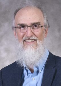
Brianna Bambic leads the Allen Coral Atlas Field Engagement team at the National Geographic Society and Arizona State University. With a coral reef biology and resource management background, she was an Independent Researcher for 7 years that culminated in a virtual reality experience of Half Moon Caye National Monument, Belize with a National Geographic Explorer Grant, helping communicate science to the public. Brianna received her MS in natural resource management from the University of Akureyri, Iceland in 2019. Her expertise includes coastal and marine management, global science communication, and developing capacity around remote sensing and mapping. With countless hours underwater and >700 logged dives, she loves spending time exploring the ocean.
AutoCarto 2022 – Early Bird Registration Extended to September 15
The early bird registration deadline for AutoCarto 2022 , the premier conference for cartography and GIScience, has been extended to September 15. This hybrid event supports both virtual and in person participation. Discounts are available for CaGIS members, students, and participants from low income countries.
Register now to take advantage of the extended deadline!
Call for Proposals: CaGIS Rising 2022-23
The Cartography and Geographic Information Society (CaGIS) invites proposals for research or outreach projects that have the potential to transform global challenges into new opportunities that advance and promote Cartography and GIScience.
Creativity, novelty, and the potential for broader impacts to society will constitute key criteria for evaluating these proposals for funding.
Proposals may request a budget up to $10,000, and CaGIS expects to fund at least one project during this funding cycle. We welcome early-career individuals or teams to submit proposals, and at least one person on the project team must be a current CaGIS member (visit cartogis.org/membership to join CaGIS).
Please see the CaGIS Rising page for more information!
GeoBytes Webinar with Rodney Jackson on the USDoL Geospatial Technology Competency Model (GTCM)
Rodney Jackson will be presenting “2022 Update of the USDoL Geospatial Technology Competency Model (GTCM)” at the next GeoBytes webinar on Friday, June 3 at 12:00 pm ET. The webinar is FREE for all CaGIS members. See attached abstract for more information about the presentation.
Please see the CaGIS GeoBytes page for more information on registering.
Abstract
In collaboration with the US Department of Labor (USDoL), the National Geospatial Technology Center (GeoTech Center) is updating the Geospatial Technology Competency Model (GTCM). The GTCM framework was developed through a collaborative effort involving the US DoL Employment and Training Administration (ETA), the GeoTech Center, and industry experts. We are seeking geospatial professionals to complete a review of the GTCM. Their commitment to participate in an assessment of the GTCM tiers via online survey will enable us to update the competency model to best reflect the knowledge, skills, and abilities (KSAs) needed in the geospatial industry.
Dr. Rodney D. Jackson serves as the Director for the Special Operations School of Information Technology (SOSIT). He has 20 years of experience in higher education, having held various teaching and administrative positions at community colleges, universities, and governmental institutions of higher learning. A geographer by training, Rodney is Certified Geographic Information Systems Professional (GISP). He prefers to fly-fish local freshwater streams during his free time. Rodney retired from the United States Army Reserves as Lieutenant Colonel in the Engineer Corps (Geospatial Designator) in 2017.
CaGIS recognizes the passing of former CaGIS President Thomas Loveland
CaGIS is sorry to report the passing of former President Thomas Loveland. Tom was a leader in the GIScience and Remote Sensing community and will be greatly missed. The U.S. Geological Survey paid tribute to Thomas in this article detailing his career, contributions, and leadership.
CaGIS Presents the 2022 Distinguished Career Award to Alan MacEachren
CaGIS is proud to honor Alan MacEachren (Penn State) with the Distinguished Career Award this year. The CaGIS Distinguished Career Award honors the accomplishments of senior professionals who have contributed substantially to the advancements of the fields of cartography, GIS or GIScience, or the interface between cartography and GIScience. CaGIS will present the award to Alan at AutoCarto 2022.
GeoBytes Webinar with Bo Zhao on Deep Fake geography? A humanistic GIS Reflection upon Geospatial Artificial Intelligence
Bo Zhao will be presenting “Deep Fake geography? A humanistic GIS Reflection upon Geospatial Artificial Intelligence” at the next GeoBytes webinar on Friday, May 27 at 12:00 pm ET. The webinar is FREE for all CaGIS members. See attached abstract for more information about the presentation.
Please see the CaGIS GeoBytes page for more information on registering.
Abstract
The ongoing development of Geospatial Artificial Intelligence (GeoAI) has raised deep concerns about the emergence of deep fake geography and its potentials in transforming the human perception of the geographic world (Zhao et al 2021). This seminar presents a humanistic GIS reflection upon GeoAI (Zhao 2022) and its social implications using an empirical study that dissected the algorithmic mechanism of falsifying satellite images with non-existent landscape features. To demonstrate our pioneering attempt at deep fake detection, a robust approach is then proposed and evaluated. Our proactive study warns of the emergence and proliferation of deep fakes in geography just as “lies” in maps. We suggest timely detections of deep fakes in geospatial data and proper coping strategies when necessary. More importantly, it is encouraged to cultivate critical geospatial data literacy and thus to understand the multi-faceted impacts of deep fake geography on individuals and human society.
Bo Zhao is an Associate Professor in the Department of Geography at the University of Washington, Seattle. His recent research interests include GIScience, geographical misinformation, and social implications of emerging GIS technologies, especially in the context of the United States or China.
2021 Map Design Competition Winners Announced
CaGIS is proud to present the winners of the 2021 Map Design Competition. We thank the many contributors and judges! Please be sure to visit the Gallery to see some of the winners from this year’s competition.
GeoBytes Webinar with Carolynne Hultquist and Cascade Tuholske on Using Geospatial Data to Evaluate Climate Hazards and Inform Environmental Justice
Carolynne Hultquist and Cascade Tuholske will be presenting “Using Geospatial Data to Evaluate Climate Hazards and Inform Environmental Justice” at the next GeoBytes webinar on Friday, April 22 at 12:00 pm ET. The webinar is FREE for all CaGIS members. See attached abstract for more information about the presentation.
Please see the CaGIS GeoBytes page for more information on registering.
Abstract
This webinar will introduce two new datasets released by NASA Socioeconomic Data and Applications Center (SEDAC): Global High Resolution Daily Extreme Urban Heat Exposure UHE-Daily) v1 (1983-2016) and U.S. Social Vulnerability Index Grids v1 (2000, 2010, 2014, 2016, and 2018). UHE-Daily is a global inventory of extreme heat events covering more than 13,000 urban settlements from 1983 – 2016 across five different extreme heat thresholds. It includes the number of people exposed to each heat event as well as 34-year exposure trends. The U.S. Social Vulnerability Index Grids data set contains gridded layers for the Centers for Disease Control and Prevention (CDC) Social Vulnerability Index (SVI) for the overall score from 15 variables and four sub-category themes (Socioeconomic, Household Composition & Disability, Minority Status & Language, and Housing Type & Transportation) based on census tract level inputs. The webinar will introduce the datasets and provide brief tutorials in Python and QGIS.
Carolynne Hultquist is a Postdoctoral Research Scientist at the Center for International Earth Science Information Network (CIESIN) at the Columbia Climate School, Columbia
University. Hultquist specializes in developing computational methods for the fusion and validation of spatial data sources to better understand complex environments, especially
vulnerability in relation to climate hazards. She holds a Ph.D. (2019) from the Pennsylvania State University in Geography and Social Data Analytics.
Cascade Tuholske is an Earth Institute Postdoctoral Research Scientist working with the Center for International Earth Science Information Network (CIESN) at the Columbia Climate School, Columbia University. His research centers on the intersection of climate change, urbanization, and food security, with a recent focus on mapping urban extreme heat exposure worldwide. He received his PhD in 2020 from the Department of Geography at the University of California, Santa Barbara.