News

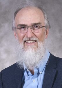
Rodney Jackson will be presenting “2022 Update of the USDoL Geospatial Technology Competency Model (GTCM)” at the next GeoBytes webinar on Friday, June 3 at 12:00 pm ET. The webinar is FREE for all CaGIS members. See attached abstract for more information about the presentation.

Please see the CaGIS GeoBytes page for more information on registering.

Abstract

In collaboration with the US Department of Labor (USDoL), the National Geospatial Technology Center (GeoTech Center) is updating the Geospatial Technology Competency Model (GTCM). The GTCM framework was developed through a collaborative effort involving the US DoL Employment and Training Administration (ETA), the GeoTech Center, and industry experts. We are seeking geospatial professionals to complete a review of the GTCM. Their commitment to participate in an assessment of the GTCM tiers via online survey will enable us to update the competency model to best reflect the knowledge, skills, and abilities (KSAs) needed in the geospatial industry.

Dr. Rodney D. Jackson serves as the Director for the Special Operations School of Information Technology (SOSIT). He has 20 years of experience in higher education, having held various teaching and administrative positions at community colleges, universities, and governmental institutions of higher learning. A geographer by training, Rodney is Certified Geographic Information Systems Professional (GISP). He prefers to fly-fish local freshwater streams during his free time. Rodney retired from the United States Army Reserves as Lieutenant Colonel in the Engineer Corps (Geospatial Designator) in 2017.

Bo Zhao will be presenting “Deep Fake geography? A humanistic GIS Reflection upon Geospatial Artificial Intelligence” at the next GeoBytes webinar on Friday, May 27 at 12:00 pm ET. The webinar is FREE for all CaGIS members. See attached abstract for more information about the presentation.

Please see the CaGIS GeoBytes page for more information on registering.

Abstract

The ongoing development of Geospatial Artificial Intelligence (GeoAI) has raised deep concerns about the emergence of deep fake geography and its potentials in transforming the human perception of the geographic world (Zhao et al 2021). This seminar presents a humanistic GIS reflection upon GeoAI (Zhao 2022) and its social implications using an empirical study that dissected the algorithmic mechanism of falsifying satellite images with non-existent landscape features. To demonstrate our pioneering attempt at deep fake detection, a robust approach is then proposed and evaluated. Our proactive study warns of the emergence and proliferation of deep fakes in geography just as “lies” in maps. We suggest timely detections of deep fakes in geospatial data and proper coping strategies when necessary. More importantly, it is encouraged to cultivate critical geospatial data literacy and thus to understand the multi-faceted impacts of deep fake geography on individuals and human society.

Bo Zhao is an Associate Professor in the Department of Geography at the University of Washington, Seattle. His recent research interests include GIScience, geographical misinformation, and social implications of emerging GIS technologies, especially in the context of the United States or China.

Join the largest Cartography and Geographic Information Science network.