CaGIS is pleased to announce that the 2019 winner of the Ph.D. Scholarship is Brent Dell from the University of Texas. Brent is advised by Dr. May Yuan and is a member of the Geospatial Analytics and Innovative Applications (GAIA) Laboratory, where his research integrates augmented and virtual reality and aerial archaeology with drones.
State of Geospatial Employment Survey
ASPRS & CAGIS are distributing the first ever State of Geospatial Employment Survey. This survey will be the largest survey of its kind providing valuable data on the state of geospatial employment, compensation and ideology across different countries, professions and types of employers.
Just click on the following link to participate in this historic event.
CaGIS Election Results

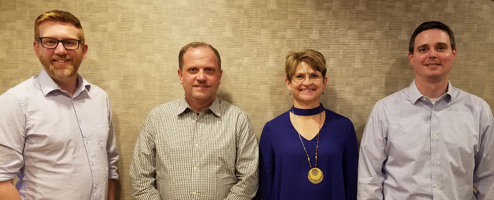
Congratulations to our newly elected CaGIS VP Thomas Pingel of Virginia Tech, and our two new Directors Kevin Hawley of the US Census Bureau & Samantha Arundel!
We also thank Howard Veregin from the Wisconsin State Cartographer’s Office and Matt Rice from George Mason University, who are rotating off the board. Thanks, Howard and Matt, for your service to CaGIS!
CaGIS Past President Kari Craun receives Gannett Award
Kari Craun, a Past President of CaGIS, has been selected as the first recipient of the Henry Gannett internal award to recognize outstanding contributions to the geospatial community by a USGS employee. Kari is Director of the USGS National Geospatial Technical Operations Center (NGTOC) and was selected for her extraordinary leadership and advancement of topographic services. More information about the award and Kari’s work as Director of NGTOC are available in the official USGS news release about the award
CaGIS Related Events at AAG
In addition to the many Cartography and GI Science related sessions at AAG this year, CaGIS would like to make sure the membership is aware of two particular events:
On Tuesday, April 2 from 6 – 8pm, CaGIS will be hosting a reception in the Johnson Room (note: not the Jackson Room as originally stated) at the Marriott Wardman Park. Hors d’ouerves and various adult beverages will be served. Come and mingle with colleagues, learn what CaGIS has been up to lately, and meet the board members of CaGIS.
On Wednesday, April 3 from 4:30 – 5:30 pm, there will be a USNC meeting held in room Delaware A, at the Marriott Wardman Park. We will be discussing the 2019 International Cartographic Conference and related activities.
Looking forward to seeing you there!
Deadlines for ICC 2019 Extended
PAPER AND ABSTRACT SUBMISSION DEADLINE EXTENDED!
We are pleased to inform you that in response to the overwhelming demand the deadline for full paper submission was extended to December 12, 2018. The deadline for abstract submission was also extended to January 8, 2019.
International Cartographic Association (ICA) encourages submissions from all interested participants from across the globe.
Visit the ICC 2019 website www.icc2019.org for the details.
ICC2019 Local Organizing Committee
If you have any enquiries, please contact: icc2019@issjp.com
29th International Cartographic Conference
The 29th International Cartographic Conference (ICC) will take place in Tokyo, Japan, from July 15-20, 2019. Interested participants should take note of the December 12 deadline for full manuscripts and the January 8 deadline for abstracts and publication in the proceedings. For more information, visit the USNC-ICA page.
Map Design and Scholarship Competitions
CaGIS is proud to announce two competitions of likely interest to its members. The Map Design Competition is open to all map-makers in the US and Canada for maps created in the past year. Students are particularly encouraged to apply, and the deadline for submission is January 31, 2019. The CaGIS Student Scholarship competition is also open. CaGIS is sponsoring both masters and doctoral scholarships. The deadline for scholarship application is January 19, 2019.
2017 Map Competition Winners Announced
CaGIS is pleased to announce the winners of the 2017 Map Competition. Thanks to all who submitted an entry!
Joint AutoCarto2018 and UCGIS Symposium
CaGIS is pleased to announce that its 2018 Symposium will be co-hosted with the University Consortium for Geographic information Science (UCGIS)! This joint AutoCarto and Symposium will explore Frontiers of Geospatial Data Science. We will consider connections between Geospatial Science and the burgeoning field of Data Science, seen in newly named academic departments and calls for funded research. At this event we will explore emerging opportunities and challenges for the geospatial and mapping sciences with an eye on trends in deep learning, data-intensive computing platforms, and visualization, as well as geospatial big data sources and applications such as location-aware social media, autonomous vehicles, and earth-observing micro- and nano-satellites and sensors.
This conference will be held Tuesday May 22 – Thursday May 24, 2018, at the historic Concourse Hotel in downtown Madison, Wisconsin.
